A new underground radar technology system developed at Louisiana Tech University (Ruston, Louisiana) is helping the coastal city of Slidell identify and document underground infrastructure damage that had gone undetected in the years since Hurricane Katrina made landfall in south Louisiana in August 2005.
Known as FutureScan†, this in situ pipe technology is a pipe-penetrating scanning system based on ultra-wideband (UWB) pulsed radar. The UWB system was first developed by the U.S. Department of Defense (Arlington, Virginia) for the military, but a team at Louisiana Tech has refined it for civilian use.
The system allows for the inspection of buried pipelines, tunnels, and culverts to detect fractures, quantify corrosion, and determine the presence of voids in the surrounding soil often caused by storm water leaks and flooding, according to the developers.
While robots have already been used to find cracks and breaks in underground pipes, the new system looks past the pipe and into the dirt, in search of empty spaces and potential sinkholes. It can help civil engineers find voids as small as 8-in (203.2-mm) deep.
Technology Developed by Louisiana Tech University
Created at Louisiana Tech’s Trenchless Technology Center, the technology incorporates simulation, electronics, robotics, signal processing, and three-dimensional (3-D) renderings, all in a package that can be mounted on existing pipe-inspection robots.

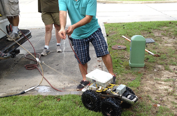
The radar device, housed in a casing the size of a smartphone box, is strapped to the top of a robot (Figure 1) and integrated into existing assessment software. As the wheeled robot travels through the pipeline, it gathers video footage, sends out signals, and processes the reflection, thus giving the operator a detailed report with a graphical display of pipe anomalies and the likelihood of voids.
Arun Jaganathan, associate professor of civil engineering and construction engineering technology at Louisiana Tech, began developing this technology in early 2009 as the basis for his Ph.D. dissertation research. Partnering with fellow Louisiana Tech researcher Neven Simicevic and others, his vision was to develop it into a tool that municipal engineers can use for their routine pipeline condition assessments.
“Our UWB technology was based on recognizing the need within the trenchless industry for an advanced pipeline inspection tool that can quantify the structural integrity of buried municipal pipes like sewers and storm drains, and be able to see through the pipe wall,” Jaganathan says.1
“The radar system emits ultra-short electromagnetic pulses from inside of a sewer pipe and captures the signals back-scattered from the pipe to determine the condition of various layers hidden behind the wall, which we cannot directly see using visual tools such as a camera,” he adds. “The radar is integrated into a robot, which crawls through a pipe and relays the data back to the operator in real time.”
Alhough other robots have used ground-penetrating radar, researchers say the antenna on those existing robots must touch the pipe; however, the antenna used on this system does not.
Application Test in Slidell, Louisiana
Jay Newcomb, a Slidell city council member and Louisiana Tech alumnus, first learned of the technology through connections with his alma mater.
“We took a trip to [Louisiana] Tech in September of 2010 to check things out and make ourselves be known to any interested companies,” Newcomb says. “At that time, Louisiana Tech’s radar technology was still in the developmental stages. But the research team said that if the innovation proved useful in lab tests, Slidell would be used as a beta site in actual field studies.”
Following successful testing and development, Jaganathan and other researchers came to Slidell in the summer of 2013 to pinpoint the spots in the city that would be most beneficial for using the UWB, and to test and investigate the underground infrastructure issues. As predicted by the group in their initial research, compromised infrastructure could be seen when using the UWB technology.
“While we were aware of the depth and breadth of the problems that plagued our underground utilities and we knew surrounding communities had experienced similar problems, I believe it wasn’t until we made the trip to Ruston in 2010 and then saw the results of the UWB investigation that we actually realized we could have quantifiable evidence of the scope of that damage,” Newcomb says.
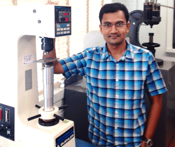
Jaganathan (Figure 2) explains that the technology is distinctive from other radars on the market.

“This technology is unique in its capability to generate high resolution images, which allow engineers to inspect a particular spot in detail,” Jaganathan says. “Unlike many other radars, our system does have to be in contact with the pipe wall, and this provides capability for rapid inspection to finish scanning a long pipe in a timely manner.”
As a result of the work of Jaganathan, Simicevic, the Louisiana Tech research team, and consultants with other engineering firms, Slidell was able to secure $75 million in funding from the U.S. Federal Emergency Management Agency (Washington, DC) to begin the underground utility restoration process.
“Our fiscal 2017 total budget for the City of Slidell is just under $43 million,” Newcomb says. “We now have almost two whole budgets to spend on streets, drainage, and sewer, thanks to the collective efforts of many, beginning with the research conducted by Louisiana Tech.”
After the successful test in Slidell, Louisiana Tech applied for and received a U.S. patent on the technology. Commercial developers with pipeline inspection company CUES, Inc. (Orlando, Florida) say they are continuing to refine the radar system to make it simpler and easier to use for clients.
Template for Future Projects
Jaganathan says the success of this project demonstrates the value of academic research.
“What started as an academic research ultimately led to the development of a practical tool that our municipal engineers can use on a daily basis for the betterment of our infrastructure and society, as a whole,” Jaganathan says.
In a state like Louisiana, which is often prone to hurricane damage based on its position on the U.S. Gulf Coast, the tool could prove quite useful in the years ahead. From a policy standpoint, Newcomb believes Louisiana would benefit from keeping a closer eye on technical research from local universities.
“I truly believe that far too many municipalities’ first response to problems is ‘Who do we hire to consult/fix this?’ instead of asking ‘I wonder if any of our public universities have researched this topic or have any prior experience dealing with a similar situation?’” Newcomb says.
“I am glad the City of Slidell asked for help from Louisiana Tech,” he adds. “All we had to do was just ask!”
The initial research on the technology was funded by $3.2 million from CUES, Inc. and $3 million from the U.S. National Institute of Standards and Technology (Gaithersburg, Maryland). Additional funds were provided by the state of Louisiana and from a $400,000 research grant by the National Science Foundation (Arlington, Virginia).
†Trade name.
Reference
1 D. Guerin, “Louisiana Tech researchers use underground radar to locate post-Katrina damage,” Louisiana Tech News Release, 08/26/2016, http://news.latech.edu/2016/08/25/louisiana-tech-researchers-use-underground-radar-to-locate-post-katrina-damage/ (September 12, 2016).